


Anzat (TNN) – In a momentous announcement, the Ministry of State has proudly unveiled the latest and most comprehensive galaxy map, detailing the extensive territory of the Tresario Star Kingdom. This intricate cartographic masterpiece is the result of a seamless collaboration between the Tresario Cartographer Guild and the esteemed Khanu’bar Institute, operating under the guidance of Ministry of State Consul General Sir Clive Redrum and Khanu’bar Institue leader, Lief Ragnos.
The creation of this comprehensive map was a complex endeavor that spanned a notable period of time. Collaborators worked tirelessly for six full rotations of the Anzat planet to ensure the precision and thoroughness of the collected data. This process involved the synchronization of data from various sources, including satellite scans, exploration missions, and hyperspace route analysis. The culmination of these efforts resulted in an expansive cartographic depiction that aptly reflects the Tresario Star Kingdom’s territorial reach.
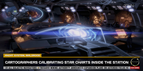
This immense undertaking was carried out aboard the cutting-edge TRS Anzatan Research for Scientific Excellence station, stationed within the Anzat System. Scientists and experts hailing from diverse worlds of Tresario worked harmoniously to merge data streams and create an accurate portrayal of the kingdom’s borders, trade routes, and celestial anomalies.
The map offers an in-depth portrayal of the Tresario Star Kingdom’s vast domain, encompassing ten sectors across the mid and outer rim. Every celestial body, trade route, and strategic point within the kingdom’s jurisdiction has been meticulously charted and documented. This newly unveiled cartographic gem is poised to serve as an invaluable resource for scholars, explorers, and strategists alike.
Commenting on this groundbreaking collaboration, Lief Ragnos, the head and founder of the Khanu’bar Institute, expressed his thoughts on how this endeavor benefits the galaxy’s inhabitants, particularly Tresario citizens:
“This collaboration between the Tresario Cartographer Guild and the Khanu’bar Institute is a beacon of progress. It demonstrates the remarkable outcomes that can be achieved when institutions pool their resources and knowledge for the greater good. This updated galaxy map not only benefits the citizens of Tresario but also provides valuable information to all sentient beings in the galaxy.”
“Access to accurate and comprehensive maps is essential for galactic navigation. It fosters understanding and cooperation among civilizations. By sharing our knowledge, we contribute to the stability and prosperity of the galaxy as a whole. I commend the Tresarian Ministry of State for its vision in spearheading this project. This collaboration sets a positive example for others to follow and reinforces the values of knowledge and progress.”
“May this map serve as a guiding star for all travelers as they navigate the vast galaxy, ensuring a more hopeful journey ahead.”
In response to this monumental achievement, Minister of State Dame Sydney von Ismay expressed her profound pride and satisfaction at the completion of this project, emphasizing its significance not only for the Tresario Star Kingdom but for the galaxy as a whole. She commended the dedication and expertise of all those involved and reaffirmed the Ministry of State’s commitment to continued cooperation in the pursuit of knowledge and progress.